9.5 Miles in North Georgia
This is your virtual trailhead for hiking and historic information about the first section of the Bartram Trail. If you’re starting a through-hike of the Bartram Trail, this initial 9.5 miles from Russell Bridge to Sandy Ford in Georgia is a likely staring point on your journey, assuming a South-to-North path.

Crossed a delightful river, the main branch of Tugilo, when I began to ascend again, first over swelling turfy ridges, varied with groves of stately forest trees, then ascending again more steep, grassy hillsides, rested on the top of Mount Magnolia, which appeared to me to be the highest ridge of the Cherokee mountains, which separates the waters of Savannah River from those of the Tanase, or great main branch of the Cherokee river…“
William Bartram, Travels
Overview
Experts believe that Bartram crossed the Chattooga River, very close to where Russell Bridge is today and could possibly have taken him past Sandy Ford on his way through North Georgia.
Historic Background
William Bartram entered this area in May of 1775, following trade paths that had been in use by native Americans. The colonists also used these routes for trade and military campaigns. Bartram crossed the Chattooga river and followed Warwoman Creek towards the abandoned Cherokee village of Stekoe. Today, this is the town of Clayton, Georgia.
In his Travels, Bartram describes Martin’s Creek Falls and Courthouse Gap, as well as trees and plants new to 18th century botany.
The Chattooga River was designated a Wild and Scenic River in 1974. As such, the beginning of the trail is also wild and scenic, much like Bartram would have experienced it in 1775.
Section Access at Russell Bridge Trailhead
To reach the Russell Bridge Trailhead, go east on Warwoman Road from Clayton for 14 miles till it ends at Highway 28. Turn right and travel south for 2 miles to the parking area on your left.
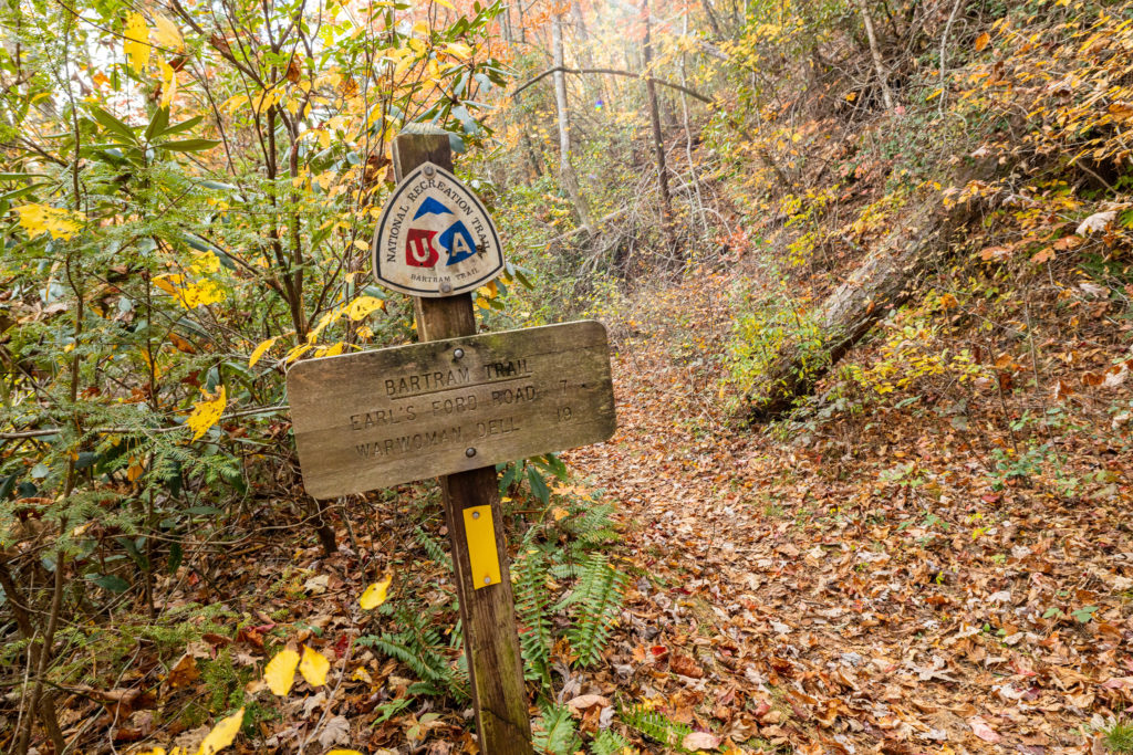
Here you’ll find a large engraved granite boulder and an information kiosk welcoming you to the trailhead. The Bartram Trail begins just across the road, following the Chattooga River. The trail is well marked with yellow rectangle blazes all the way through to North Carolina.
Section Highlights
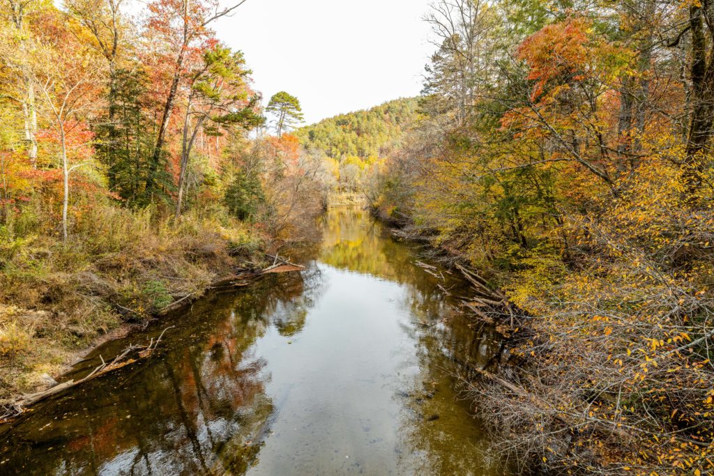
- The trail follows the West Fork of the Chattooga River and crosses over a suspension bridge. You can view the confluence of the West and North Forks of the Chattooga River, creating the main headwaters of the river.
- The trail follows the river downstream for a mile. It passes the ancient site of the Cherokee Village named Chattooga Old Town, which sits on the opposite side of the river.
- In the late 19th and early 20th century, travelers would have stopped here at the historic Russell Farm to rest up on their way to the Highlands, North Carolina.
- After periods of heavy rain, you may encounter the Adline Branch footbridge flooded at around 2.5 miles. A little bushwhacking upstream from here will provide alternate opportunities for safe crossing.
- You’ll cross Warwoman Creek on a long metal footbridge at 6.3 miles.
- Continuing, you’ll reach Earl’s Ford Road, an ancient ford across Warwoman Creek. William Bartram is believed to have crossed here.
- Pay attention to follow the yellow blazes around mile 8.3.

- Near the end at 9.1 miles, you’ll want to take the extra steps to visit Dick’s Creek Falls and the Chattooga River.
- You will need to ford the river here, as the bridge is currently out from storms in 2020. Use caution and hiking sticks, if you have them.
- The Chattooga River trail spurs off the Bartram at 9.4 miles, marked by green rectangle blazes.
- The end of this section at Sandy Ford Road is at mile 9.5. There is parking just north on Sandy Ford Road, for those looking to park a pickup vehicle or have a shuttle waiting.
Check out our trail report post from our hike on this section from October 28, 2022.