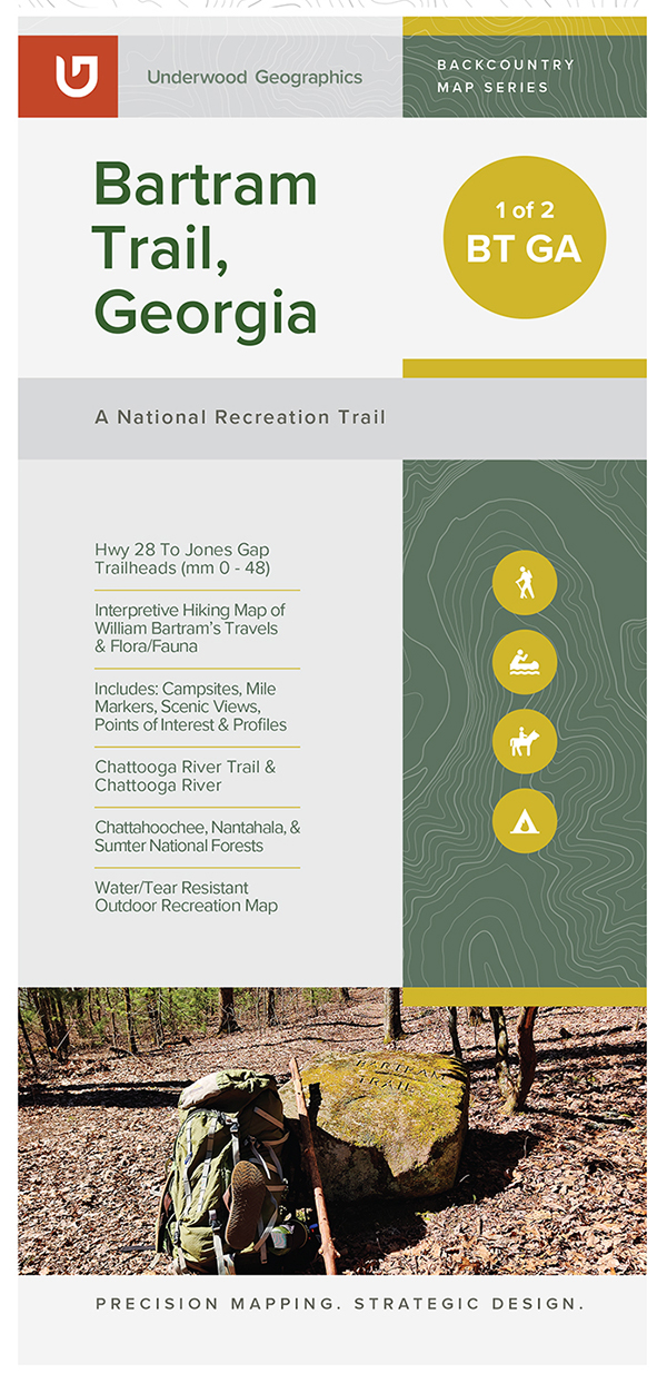
• Skip to primary navigation
  • Skip to main content
Blue Ridge Bartram Trail Conservancy

Blue Ridge Bartram Trail Conservancy

History. Art. And the Great Outdoors.

  • About the Trail
    • The Bartram Trail Map
      • Section 1: Russell Bridge to Sandy Ford
      • Section 2: Sandy Ford to Warwoman Dell
      • Section 3: Warwoman Dell to Wilson Gap
      • Section 4: Wilson Gap to Georgia/North Carolina Border Near Hale Ridge Road
      • Section 5: Hale Ridge Road to Jones Gap
      • Section 6: Jones Gap to Hickory Knoll Road
      • Section 7: Road Walk from Hickory Knoll Road to Wallace Branch
    • Hiking the Trail
      • Walking With Bartram
      • Tell Us About Your Bartram Trail Hike
      • Thru-Hikers
    • William Bartam
  • About Us
    • Our Mission & History
    • Contact Us
  • Trail Maintenance
    • Report Trail Conditions
    • Report Completed Trail Maintenance
    • Read Trail Reports
    • Trail Maintenance Basics
  • Events
    • All Events
    • BARTRAM 250
    • Friends of William Bartram Fundraiser
  • Support
    • Become a Member by Donating
    • Volunteer on the Trail
    • Bartram Trail Programs
      • 2023 Public Lands Corps
      • 2022 Public Lands Corps
      • Macon Youth Trail Corps
    • Bartram Trail Hiking Map Sponsors
  • Blog
  • Shop
    • Cart
    • Checkout
    • My account
  • DONATE
  • Show Search
Hide Search
🔍
2022 Hiking Map of Georgia’s Bartram Trail

Hiking Map of Georgia’s Bartram Trail

$17.00

This new 2022 Hiking Map of Georgia’s Bartram Trail includes updated routes of the Bartram Trail in North Georgia. It also includes additional regional trails and points of interest. Coverage in the Georgia companion map includes the Chattooga River Trail and Chattooga River, Ellicott Rock Wilderness Area, and the Chattahoochee, Nantahala, and Sumter National Forests.

Category: Maps and Guides Tags: chattahoochee, chattooga, ellicott rock wilderness, georgia, guides, maps, rabun bald, warwoman dell
  • Description

Description

Printed in full color on waterproof/tear-proof paper, the map includes:

  • An overview of the 30+ miles of the yellow-blazed Bartram Trail in Georgia
  • Blue-blazed side and connector trails
  • Topographic features
  • Elevation profile for Georgia stretch of the trail
  • Area places of interest: scenic vistas, waterfalls, historic markers, picnic areas and campgrounds
  • Many natural history facts about the biodiversity of native flora and fauna along the BT, about William Bartram and about the Blue Ridge Bartram Trail Conservancy.

This new 2022 Hiking Map of Georgia’s Bartram Trail includes updated routes of the Bartram Trail in North Georgia. It also includes additional regional trails and points of interest. Coverage in the Georgia companion map includes the Chattooga River Trail and Chattooga River, Ellicott Rock Wilderness Area, and the Chattahoochee, Nantahala, and Sumter National Forests.

This new Hiking Map of Georgia’s Bartram Trail is a companion map to our Hiking Map of North Carolina’s Bartram Trail, also available for sale. Both maps provide a comprehensive view of the trail, points of interest, and details needed to accompany any hiker.

Published on:
September 9, 2022

Explore more

Donate Volunteer Get Trail Maps

Footer

Blue Ridge Bartram Trail Conservancy

51 Cowee School Drive
Franklin, NC 28734

Copyright © 2025

Keep In Touch

  • Email
  • Facebook
  • Instagram
  • LinkedIn
  • Twitter
  • YouTube