Section 3
Warwoman Dell to Wilson Gap
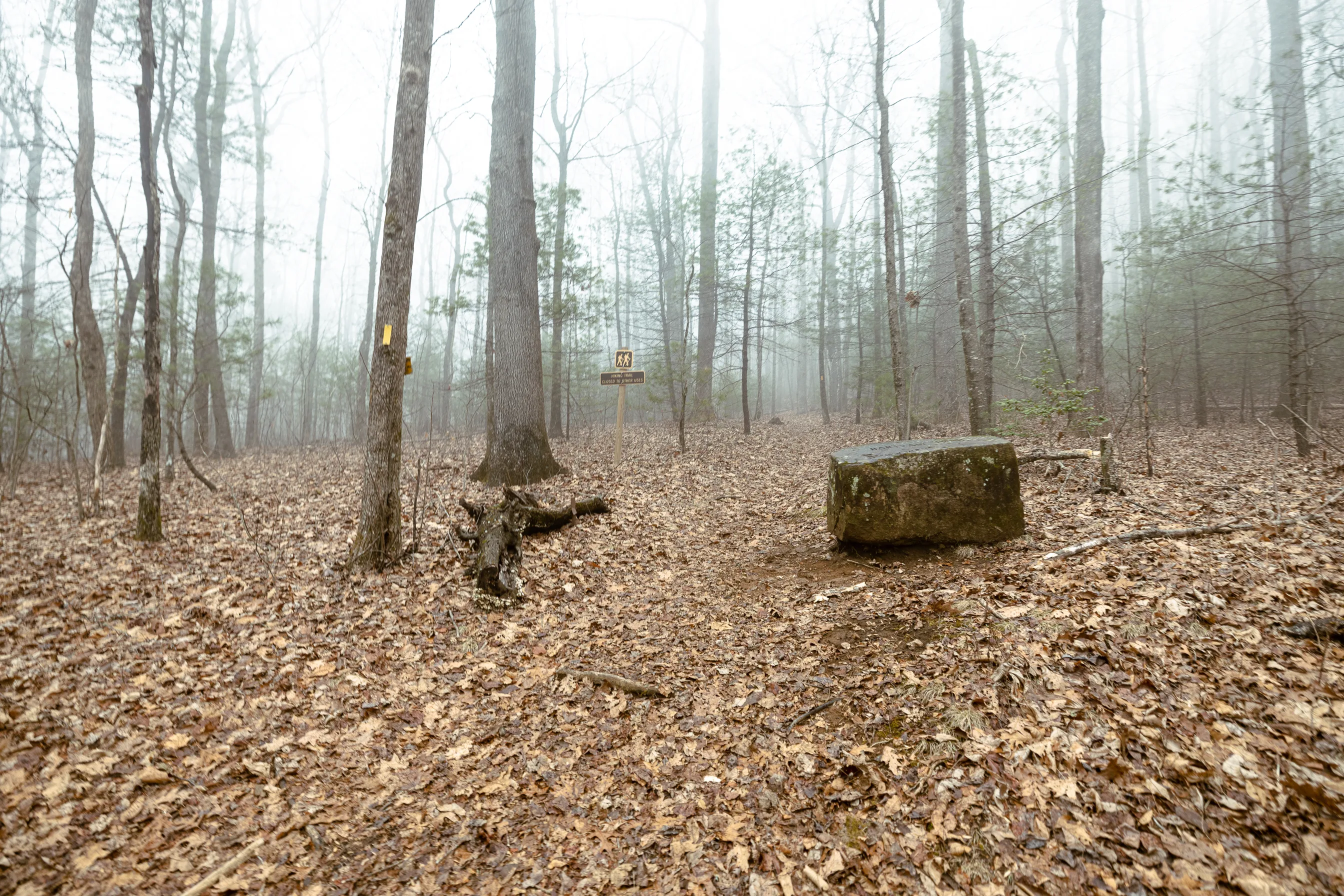
Warwoman Dell
34.8823, -83.3504
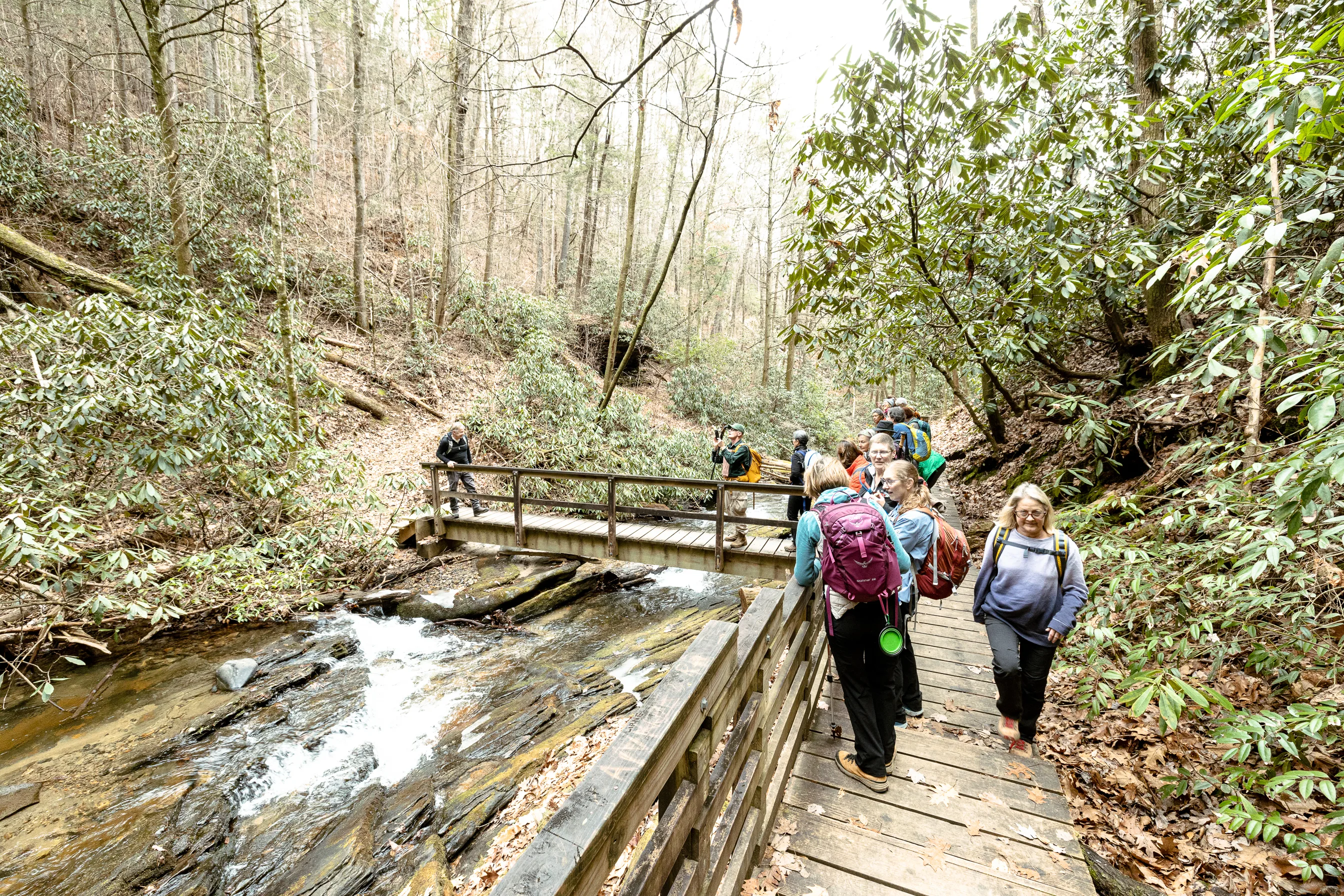
To access Warwoman Dell from Highway 441 in Clayton, travel east on Warwoman Road for three miles. A Forest Service sign will be on the right. The parking area on the left upon entry is just a few feet from where the Bartram Trail heads up Becky Branch. Hikers going towards Sandy Ford can drive on to the parking area at the end of the road. There is a composting privy there and a large pavilion with a fireplace, as well as an easy short loop trail to a waterfall and an interpretive kiosk.
From
William Bartram, Travels
"After passing through this meadow, the road led me over the bases of a ridge of hills, which as a bold promontory dividing the fields I had just passed for expansive green lawns. On these towering hills appeared the ruins of the ancient town of Stecoe. Here was a vast Indian mount or tumulus and great terrace, on which stood the council house, with banks encompassing their circus; here also were also old Peach and Plumb orchards, some of the trees appeared yet thriving and fruitful . . ."
The Journey Ahead
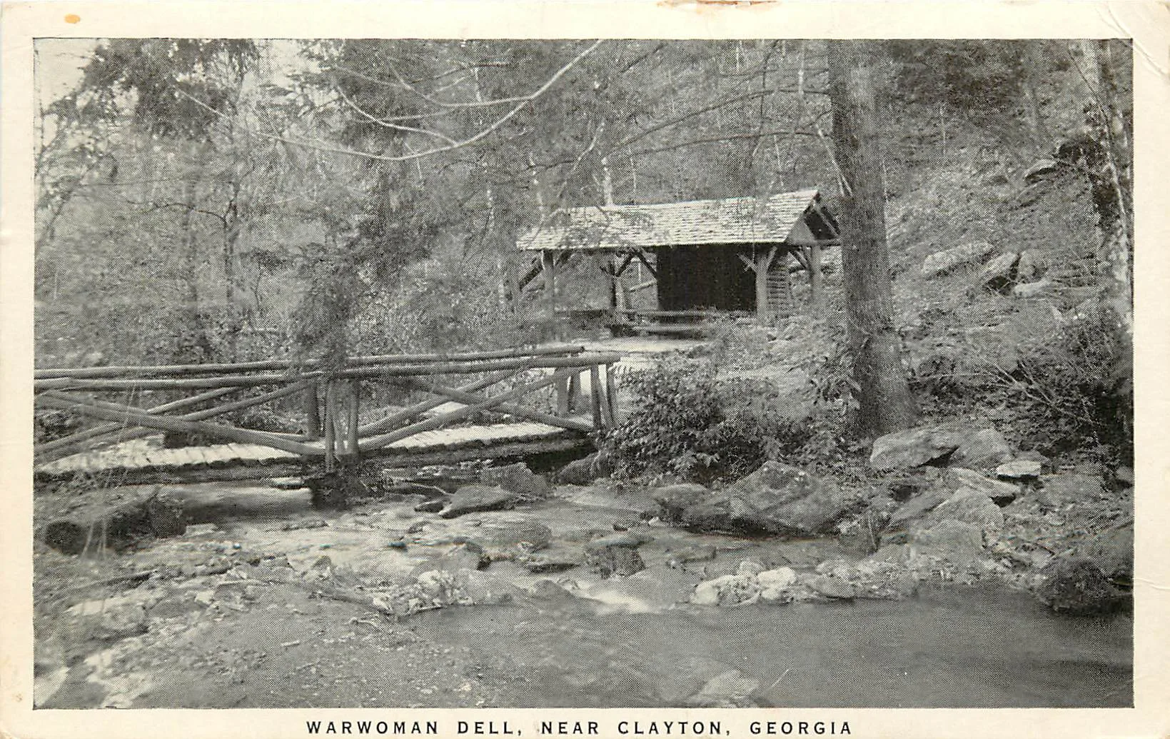

At Warwoman Dell, the CCC built the covered structures that are still in use, along with Trout runs, spring houses, and other features. Warwoman’s name is derived from the Cherokee woman Nanyehi or Nancy Ward, born circa 1738 in the Cherokee capital town of Chota in now southeastern Tennessee. Her mother was the sister of Atakullakullah, the Cherokee Chief who William Bartram would encounter on his journey out of the Nantahala Mountains. Nanyehi was awarded the title of Ghigau or Beloved Woman by the Cherokee for her role in the 1755 Battle of Taliwa against the Muskogee Indians. Ward picked up the gun dropped by her slain husband in the battle and led the Cherokee to victory, securing the north Georgia region for the Cherokee people. As Beloved Woman, she became the only female voting member of the Cherokee General Council. She later married the Irish trader, Bryant Ward, and took the name Nancy. Bryant Ward was already married to a woman in South Carolina however, and he left Nancy after a short period and returned to his other family. Ward went on to perform many important roles with the Cherokee, including negotiating a peace agreement, the Treaty of Hopewell, with American Revolutionaries following the Revolutionary War.
Another theory for the place name of Warwoman is that it is named for Nancy Morgan Hart, famous for her exploits against Loyalists in northeast Georgia during the Revolutionary War. Hart had settled with her family in Georgia’s upper Broad River valley during the early 1770’s. Among the many of accounts of her interesting life is one in which she killed two Loyalist soldiers who showed up at her home demanding food and beverage. She offered them food and beverage and asked the group that they place their guns against the wall. She slowly removed them out the window to her husband as they continued to drink before killing two of them with their own weapons. The remainder of the group were hanged outside by her husband.
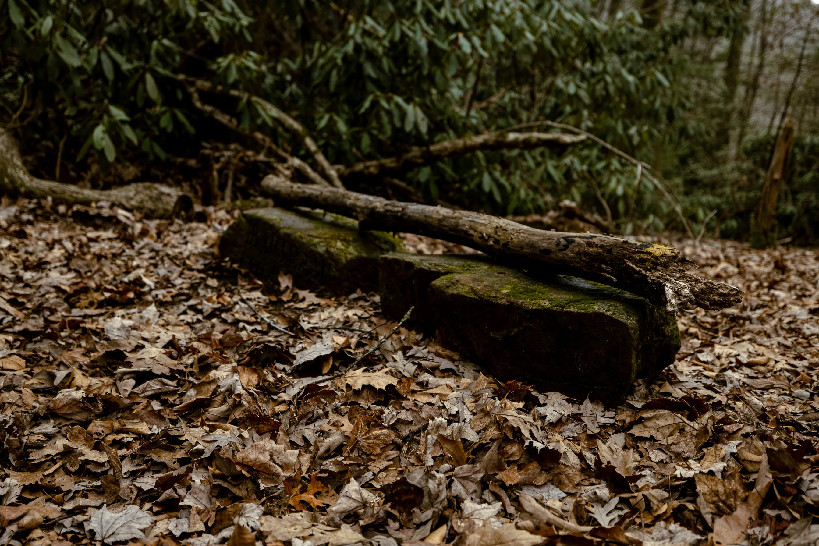
Evidence of the failed 19th century Blue Ridge Railroad is also evident at the Dell. Construction had begun prior to the Civil War, with numerous investors and schemes which continued after the war. Had the railroad been completed Rabun County would have been a major connection between Charleston, Knoxville, and other southern cities with the result being that the surrounding landscape would likely have been much less rural and remote.
This section also crosses the historically accepted route and ancient trade path upon which Bartram travelled by horseback, though the previously mentioned route proposed by cartographer Lamar Marshall is more likely. Bartram is believed to have crossed the Chattooga at Earl’s Ford, then proceeded up Warwoman Creek from Earl’s on an old trade path to Martin’s Creek Falls, crossing over the Blue Ridge mountains at Courthouse Gap. Hikers can pass by or take the side trail to the Pinnacle, where Bartram has historically been believed to be when describing a new species of magnolia - Mountain Magnolia, or Magnolia fraseri, as it was later to be described by the French botanist Andre Michaux. This species, with its large lobed leaves and smooth grey bark, was however later named Magnolia Fraseri by French Botanist Andre Michaux, who explored the area in the 1780’s and had learned of the species from Bartram. Michaux named the species after a patron, the Scottish botanist John Fraser.
From here it has been generally accepted that Bartram crossed Courthouse Gap on an ancient trail and proceeded down to the destroyed and abandoned Cherokee Village of Stekoe, near modern day Clayton. On this section of his journey, he describes hundreds of acres of strawberries, and expansive green lawns, the remains of Cherokee agriculture. In Stekoe, he describes stone piles in the old village, which he assumed were the interned remains of Cherokee warriors, killed in the earlier Creek wars. He also described the mound of the village that was later razed for the modern-day town of Clayton. Stekoe was known as The Dividings, as numerous ancient trade paths intersected at this location. One was the path northward to Cowee, and another was to the northwest through the Hiwassee River valley and on to the Overhill Towns, Bartram’s ultimate destination, which was near modern day Loudon, Tennessee. However, he was to meet a guide to lead him to the Overhill Towns in the Cherokee village of Cowee, who never showed, leading to his solo journey into the Nantahala mountains along yet another ancient route.
Common FAQs
Nope!
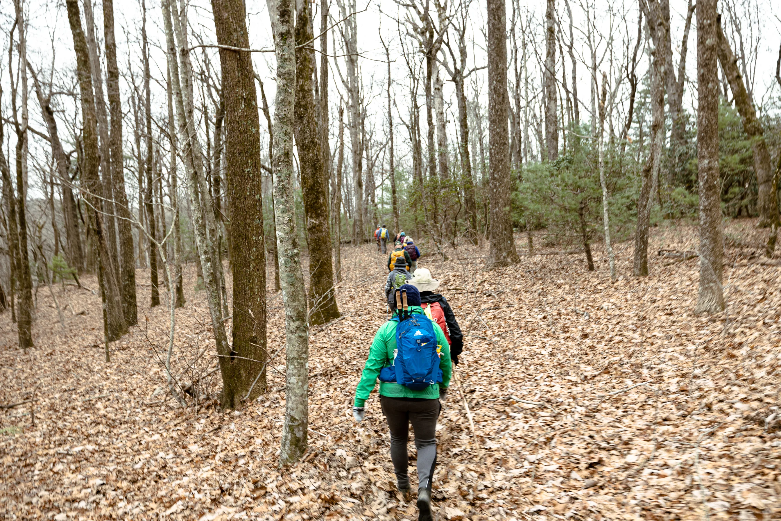
Less experienced hikers might benefit from hiking more popular sections, where access is easier and where they might feel more comfortable knowing that there are other hikers close by to answer questions about logistics, trail conditions, and so on. Most of the major access points for the trail in North Carolina have informational kiosks.
Popular Sections/Trailheads include: Warwoman Dell, Wallace Branch, Little Tennessee River Greenway, Wayah Bald, & Appletree Campground
Whether planning a day hike on the Bartram Trail or an extended trip, consider your abilities for elevation gain and the associated distances, as these are two major factors in enjoying your hike. Many of the Bartram sections are also easier to travel north to south, as there is a general loss of elevation as one proceeds south, particularly in Georgia. Regardless, if you are not an experienced hiker, start with hikes under five miles, and check our website for information on trail conditions.
Short Answer: the best time to hike is anytime you can get away on the trail & anytime there is a weather forecast that doesn’t have dangerous conditions as a possibility.
Long Answer: Spring and Fall are the two seasons most pleasant for hiking, as well as the two seasons when wildflowers are the most spectacular. Depending on the section you’re hiking, hikers must prepare for stream crossings, steep elevation gains and losses, uneven and rocky terrain, lack of water, rapidly changing weather conditions, or all of the above. Temperatures are cooler at the higher elevations, and summer rains can leave a hiker chilled to the point of hypothermia if caught unprepared. Winter can include crisp, bright, warm days followed by subfreezing temperatures, snow, and/or ice. The Bartram Trail passes through a high rainfall area, with over 100 inches of rain in a year not uncommon. Choose a time and difficulty that will best suit what you are looking to gain/experience with your BT hike!
Practice the seven principles of Leave No Trace:
- Plan Ahead & Prepare: Includes reaching your destination, checking regulations, preparing for potential hazards, & packing appropriately.
- Travel & Camp on Durable Surfaces: Choose established trails and campsites, or areas that are already impacted, to avoid disturbing vegetation and fragile ecosystems.
- Dispose of Waste Properly: Pack out everything you pack in, including food scraps, toilet paper, and other trash. Human waste should be disposed of properly, away from water sources and campsites.
- Leave What You Find: Do not remove natural objects like rocks, plants, or artifacts. Leave the environment as you found it for others to enjoy.
- Minimize Campfire Impacts: Use existing fire rings or fire pans, keep fires small, and ensure fires are completely extinguished before leaving.
- Respect Wildlife: Observe wildlife from a distance, avoid disturbing their habitat, and do not feed animals.
- Be Considerate of Other Visitors: Respect other people's outdoor experiences by being mindful of noise levels, keeping a safe distance, and being courteous on trails.
HERE is a blog post that goes more in depth on having a safe trail experience. In short:
- Always follow the yellow blazes!
- Make sure you bring plenty of water and food for your journey.
- Have someone at home know where you are and how long you plan on being there.
- Purify your drinking water.
- Be aware of hunting season (typically from early autumn through February).
- Be prepared for wading stream sections and how rain can cause streams to swell quickly.
- Check Forest Service Websites for road closures.
- Bring enough supplies to last through an emergency.
- Prepare for the worst, hope for the best!
Yes, but it is advised to keep your pets leashed and under control. Bear, deer, coyotes, and many other animals share the forest that the Bartram trail passes through. A dog you think might be under your control but unleashed could take off after anything, and you might spend a long time trying to find it – and it could have had a bad encounter resulting in injuries or death. Also, it is respectable to other hikers who may not appreciate dogs, as well as other dog owners who keep their dogs leashed.
You can submit a trail story by emailing our Membership Development Coordinator, Fiona Howell. Her email is fiona@blueridgebartram.org. Make sure you include your name, any pictures & captions you want, and a story you are comfortable with us posting on our site and socials.
What you bring on a hike can differ greatly based on distance, topography, weather, and what your interests are for the experience. Check the weather! Some basic items for a short hike (2-4 miles) are a daypack with water, snacks, rain gear (even if there’s a slight chance), and a basic first aid kit. For a longer hike, be prepared for a change in weather (raingear, extra layer, extra socks).
Still have questions?
We're here to help!
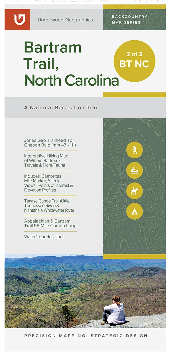
Hiking Map of North Carolina’s Bartram Trail
$17.00
Hiking Map of Georgia’s Bartram Trail
$17.00
Stay in Touch
Subscribe to stay up-to-speed on trail news, upcoming events, merch drops, trail conditions, and more.